|
 Monday Monday
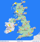
A cold start with frost and icy patches again possible. Mainly dry through most of the morning across England and Wales with some sunshine, but with then rain, sleet and snow developing across Scotland and Ireland later in the day. Snow flurries are possible in SE England through the day. Highs 0C to 4C.
 Monday Night Monday Night
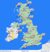
Snow flurries continue across SE England on Monday night but emphasis is on much of the country having a dry, clear and very cold night with a harsh frost and local icy patches. Into the early hours of Tuesday and sleet and snow will move down into N England. Lows -5C to 1C.
 Tuesday Tuesday
Cold or perhaps very cold with frost and icy patches, while sleet and snow through central areas slowly dies away through the day, and with then blustery wintry showers developing across many northern and western areas, these often as snow across inland areas. Highs 0C to 4C.
 Wednesday Wednesday
Uncertainties over the details, but showery in the north and west, likely wintry especially on hills, England and Wales often dry with some bright or sunny spells but with overnight frost and ice for many areas, but with perhaps a few wintry showers in the south-east for a time. Highs 1C to 4C.
|


