|
 Thursday Thursday
A continued murky easterly pattern across many areas. Grey skies, hill fog and patchy drizzly rain for central and eastern regions. Brightest in the west and north-west, although the sunshine quite hazy. Southern coasts may also see some sun. Strongest winds in the north-east, light winds in the south. Chilly in central and eastern regions, only 6 to 8C beneath leaden skies. Highs of 12 to 15C in sunnier locations in the south and west.
 Thursday night Thursday night
Staying overcast for many places. Some patchy rain or drizzle, which may locally become more organised for a time in central-southern areas, and later in the night rain in likely to become steadier in the north-east. Some cloud breaks mainly toward the west, but overall it will stay frost free. A light east to north-easterly breeze, strongest around North Sea coasts. Lows 4 to 8C.
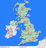 Friday Friday
Slack low pressure lies across central Britain and fronts pivot north-west across Scotland and northern England. Persistent rain for the north-east, and generally damp for many northern regions. Tending to improve across Wales and the Midlands, with early low cloud and patchy rain breaking up, leaving occasional sun and local showers. Light winds for most, and easterly breeze in the north. Highs 10 to 13C, but just 6C in eastern Scotland.
 Saturday Saturday
A light southerly airflow across the country brings a pleasant day to many places. Early morning low cloud or fog will break up and clear, resulting in good spells of sunshine developing. A few heavy showers may break out in the afternoon, focused on central and south-eastern England. Isolated bursts could pop up almost anywhere, but many places should escape dry. Fairly mild, highs 12 to 17C.
|
