|
Issued: 1000hrs Sunday 15th April 2018
Duty forecaster: Garry Nicholson
Strong sunshine, but local coastal fog
Very warm air from southern Europe will waft toward Britain during this week, bringing a taste of summer. A good deal of dry weather, although some rain affects the north and west early in the week. Later a risk of thundery showers breaking out, but these quite hit and miss.
For the weather for the next few days click here
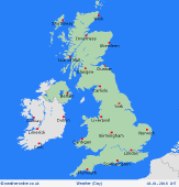
 Wednesday 18/04/18 Wednesday 18/04/18
High pressure centred toward the east, pushes fronts away to the north and west. Generally dry and plenty of sunshine, best in central and eastern areas. Some western coasts may hang onto areas of low cloud or sea fog. A warm south to southeasterly airflow. Breezy in the north & west, lighter winds and sea breezes south & east. A risk of some rain for western Ireland, but should clear. Highs 18 to 23C, cooler near coasts.
 Thursday 19/04/18 Thursday 19/04/18
Very warm across the British Isles with high pressure and a slack southeasterly pattern. Dry with lots of sunshine overall, but increasingly hazy. Light winds and seas breezes. Cooler around coasts, perhaps local fog patches south and west. Chance of local showers for western Scotland and the west of Ireland. Inland, temperatures widely feeling like early summer at 18 to 23C, locally perhaps warmer in favoured spots to the north of high ground.
 Friday 20/04/18 Friday 20/04/18
Staying dry and warm for most. Chance of mist patches near some coasts. Otherwise lots of sunshine, although quite hazy skies. A chance of local thundery bursts of rain developing. Light winds, coastal sea breezes. Highs 20 to 25C England and Wales, although western Scotland and Northern Ireland may be nearer 15C where there will be more cloud and a westerly breeze, perhaps a few showers.
Saturday 21/04/18
High pressure remains nearby. Generally still warm, but a risk of local areas of thundery rain spreading, most likely toward the south-west. Many places may escape dry. A southwesterly wind in Scotland brings cloud and a little rain to the far north-west. Highs 14 to 18C north, 17 to 21C central areas, 22 to 25C south.
Sunday 22/04/18
Detail very uncertain. Likely still warm or very warm with a general southerly airflow. Dry for many, but scope for areas of thundery rain, probably focused toward the west as fronts try and nudge in from the Atlantic. Highs 16 to 24C.
Monday 23/04/18
Low confidence of detail. A risk of becoming more unsettled as pressure falls and fronts come in from the west. Areas of rain, possibly heavy and thundery. A chance that central and south-eastern Britain may escape dry. Highs 15 to 23C.
|
