|
Often unsettled for most of the period with further rain or showers but perhaps drier and brighter by the end of the week, potentially warmer too
For the weather for the next few days click here
Thursday 12/4/18
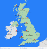
High pressure is set to dominate to the north or north-east of the British Isles as low pressure persists just to the south so something of a north and south split in the weather is set to continue with more northern areas generally drier and brighter, but with England and Wales still maintaining a risk of some showers and perhaps with then longer spells of rain moving up into southern areas of England later in the day. Moderate or perhaps fresh E'ly winds are likely to continue so temperatures average at best and always cooler near to the N Sea. Highs 7C to 13C, just 4C to 6C in eastern areas.
 Friday 13/4/18 Friday 13/4/18
At the moment Friday may well become more widely unsettled as low pressure drifts northwards across the British Isles. It may still be drier and brighter, at times, across Scotland and Ireland despite some showers here, while England and Wales may see a greater risk of rain or showers thorugh the day. All areas rather cool, especially in eastern areas. Highs 7C to 11C, but nearer 5C to 7C in eastern areas.
 Saturday 14/04/18 Saturday 14/04/18
Next Saturday is still set to see low pressure close-by to more southern and south-western areas of the UK, so still a risk of some showers here, despite some drier intervals. With high pressure still expected to be dominant to the north or north-east then more northern areas are still expected to be drier with some bright or sunny spells. Winds more SE'ly so less chilly in the east and temperatures, overall, near to average with highs around 9C to 14C.
 Sunday 15/04/18 Sunday 15/04/18
Low pressure may well maintain further unsettled and often showery conditions across parts of England, Wales and perhaps extending into Ireland as well through the day, but still with drier conditions across parts of Scotland. Winds SE'ly and perhaps chilly across E Scotland, but otherwise temperatures will be near to average and in-between any showers it will be pleasant enough. Highs 9C to 15C.
Monday 16/04/18
Uncertainties by next Monday but further unsettled conditions with a risk of showers and perhaps some longer spells of rain are predicted across more western areas of the British Isles as low pressure continues to dominate to the south-west. Drier conditions, but perhaps with some showers are forecast to be maintained across Scotland. Winds light or moderate S or SE'ly and potentially very mild if not rather warm in places, highs 10C to 16C.
Tuesday 17/04/18
While low confidence in the evolution there is evidence to suggest a transition towards high pressure and more settled conditions may develop more widely across the British Isles through next week. Some showery conditions may continue across Ireland and W Scotland but, otherwise, a mainly dry day is currently predicted with some bright or sunny spells and very mild if not rather warm for most. Highs 11C to 17C.
|


