|
Issued: 0900 Monday 2nd April 2018
Duty forecaster: Dr. Simon Keeling
Changeable, milder overall although a cool weekend
Staying changeable through the coming week. Low pressure to the west means that it will be these western areas that see most rain. Higher pressure trying to build to the east allowing for some drier weather here. After becoming milder for most this week there are hints of colder weather trying to return into the weekend for a short time. Things may then become drier and milder again next week.
 For the weather for the next few days click here For the weather for the next few days click here
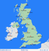
Thursday 5/4/18
A ridge of high pressure over the country on Thursday, although low pressure to the west.The low pressure brings wind and rain in Ireland and western Scotland with some drizzle on western coasts and hills too. Eastern and southern areas tending to be drier with some sunny spells. Highs at 5C in northern Scotland, 9 to 12C in southern England and Wales.
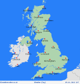
 Friday 6/4/18 Friday 6/4/18
Low pressure over the north and west of the UK and Ireland. Cloud and outbreaks of rain and drizzle. Drier in eastern and southern areas with some bright spells, perhaps becoming very milder here. Highs at 11C on western coasts, 16C in eastern England.
 Saturday 7/4/18 Saturday 7/4/18
Pressure remains low on Saturday, this again centred over the west of the country bringing showers and rain here. The risk of some bands of showery rain in more eastern and southern areas too. Highs at 11 to 16C.
Sunday 8/4/18
Sunday is likely to be bringing lower pressure south of the UK with higher pressure to the north. The south could be cloudy with rain, whilst northern areas will be drier with bright or sunny spells. A strong east to northeast wind making it feeling colder, especially in the east. Highs at 6 to 10C.
Monday 9/4/18
Low pressure stays to the south with higher pressure to the north on Monday. This brings dry conditions in Scotland and northern England but more southern areas may see cloud and some showery rain. Better weather may arrive in the east later. Mild in the far south at 14C, cold for the north of the UK at 5 or 6C.
Tuesday 10/4/18
Higher pressure may affect all areas on Tuesday. This brings a drier day with the best sunshine in the west. A risk of some more cloud in the east. Highs at 8C on eastern coasts but to 14C in the west.
|
