|
Issued: 0930hrs Thursday 16th November 2017
Duty forecaster: Garry Nicholson
A battle between cold and mild air masses
A rather stagnant weather pattern is expected during the week ahead. Slack pressure patterns and fairly weak fronts are likely to result in frequently dull conditions, and some rain at times. A chance for some brighter periods, but these probably rare. Toward the final part of November, chilly weather looks most likely, which may bring brighter skies, but a greater risk of overnight frost.
For the weather for the next few days click here
 Sunday 19/11/17 Sunday 19/11/17
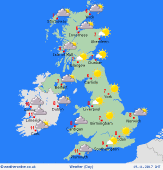
A fairly quiet day overall, with slack high pressure residing across the British Isles. Some bright and sunny spells. A cool northerly breeze is likely to affect eastern districts, whilst winds will be very light for many places. Some mist and murk may linger in central regions, and perhaps also around south-western coasts. A weak front brings cloud and patchy rain to Ireland and south-western Britain. Local showers near North Sea coasts. Cool at 6 to 9C.
 Monday 20/11/17 Monday 20/11/17
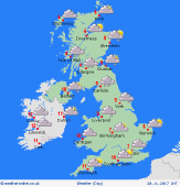
Pressure remains quite slack, whilst fronts move into the north-west. Precise detail is difficult as this stage, but a zone of chilly, grey and wet weather is possible across Scotland, N.Ireland & northern England, with a risk of snow over the hills, perhaps as low as 300-400m. A cloudy but milder picture for southern regions, with a risk of fog and general murk. It may struggle to do better than 5C in the north-east, but reaching 10 to 13C in the south-west.
 Tuesday 21/11/17 Tuesday 21/11/17
Another rather benign, dull November day looks to be on the cards. Winds fairly light. The remnants of previous fronts draped across the country are likely to bring extensive cloud cover, with some low level mist and fog, plus some outbreaks of rain or drizzle. Again, something wintry is possible over northern hills. Chilly toward the north & east at around 5 to 7C. Milder south & west at 10 to 13C.
Wednesday 22/11/17
An area of low pressure may try and move into the North Sea, but overall the pressure pattern may remain stuck in a rut. Rather grey and murky, with some rain around, which may become persistent and heavy locally. Winds mostly light, although a chance of things becoming more mobile. Fairly mild, 8 to 13C, but likely to be cooler where rain develops.
Thursday 23/11/17
Low confidence: Indications favour high pressure becoming focused to the north of Britain, ushering in cooler air from the north or north-east. Some wet conditions may affect southern areas, where it may be fairly mild, whilst brighter skies and wintry showers are more likely in the north. Highs 5 to 10C.
Friday 24/11/17
Low confidence: A chilly, but perhaps brighter outlook may develop by the end of the week, but detail is very uncertain. Some areas of rain or wintry showers are possible. Risk of overnight frost where skies clear. Highs 4 to 8C.
|


