|
Often unsettled, especially in the north and west, perhaps drier in the south late on. Cool or rather chilly for most.
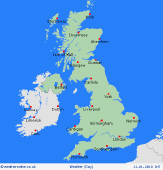
For the weather for the next few days click here
Monday 23/4/18
A far cooler and more unsettled day than compared with previous days across all areas of the British Isles as low pressure moves in from the west. This means a risk of rain or showers, at times, across many areas but with perhaps more northern and western areas experiencing the heaviest precipitation through the day, while more southern and eastern areas of England may well still be drier and brighter at times. Highs just 9C to 14C which is near average, but clearer markedly cooler than previous days.
 Tuesday 24/4/18 Tuesday 24/4/18
Low pressure will develop and dominate to the north and north-west of the British Isles bringing a continued risk of rain or showers at times through the day, but with more northern and western areas at greatest risk of some heavy rain or showers at times, perhaps windy here too with a fresh W'ly wind. Still drier and brighter in the south and east but scattered showers are possible. Highs 8C to 14C.
 Wednesday 25/04/18 Wednesday 25/04/18
Little change at the moment with low pressure remain slow moving to the north and this maintaining unsettled conditions. Scotland, Ireland, N England and Wales seeing the greatest risk of rain or showers at times, still windy here as well with a fresh or perhaps strong W or NW'ly wind. Showery weather is likely in the south and east too but with some drier and brighter intervals. Cool, if not feeling rather chilly in the wind, highs 7C to 12C.
 Thursday 26/04/18 Thursday 26/04/18
Some uncertainty by next Thursday but a particularly cool and showery day is forecast, perhaps especially in the north and east, while more southern and western areas may gradually become drier and brighter through the day, especially in the south-west. Still rather windy with winds W or NW'ly moderate or fresh and, again, feeling cool or rather chilly. Highs 7C to 12C.
Friday 27/04/18
Into Friday and a chilly start is forecast across inland areas, perhaps with a slight frost. Showery weather may well continue across some northern and eastern areas, but otherwise a brief 'window' of drier and brighter, if not sunnier weather is forecast for most through the day. Later in the day though and wet and windy weather may return to Scotland and Ireland with a fresh or strong SW'ly wind here. Temperatures not far from average after the chilly start, highs 8C to 14C.
Saturday 28/04/18
Changeable but often unsettled in the north and west at the moment with further wet and windy conditions possible, more central and southern areas of the UK may remain drier and brighter, especially across S England and S Wales, but some showers can't be ruled out. Temperatures near to average, highs 8C to 14C.
|
