|
After the current warm weather it is expected to become much cooler and also unsettled as next week progresses
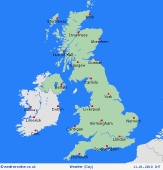
For the weather for the next few days click here
Sunday 22/4/18
One final warm or very warm and humid day is forecast across much of England and Wales through the day but with an increased risk of some heavy and thundery downpours developing as the day progresses and these moving eastwards through the day. Turning cooler and fresher than previous days across much of Scotland and Ireland where showery weather is predicted and then turning cooler across N England by the end of the day. Highs 18C to 23C in the south and east, around 13C to 18C across Scotland and Ireland.
 Monday 23/4/18 Monday 23/4/18
A far cooler and more unsettled day than compared with previous days across all areas of the British Isles as low pressure moves in from the west. This means a risk of rain or showers, at times, across many areas but with perhaps more northern and western areas experiencing the heaviest precipitation through the day, while more southern and eastern areas of England may well still be drier and brighter at times. Highs just 9C to 14C which is near average, but clearer markedly cooler than previous days.
 Tuesday 24/04/18 Tuesday 24/04/18
Low pressure will develop and dominate to the north and north-west of the British Isles bringing a continued risk of rain or showers at times through the day, but with more northern and western areas at greatest risk of some heavy rain or showers at times, perhaps windy here too with a fresh W'ly wind. Still drier and brighter in the south and east but scattered showers are possible. Highs 8C to 14C.
 Wednesday 25/04/18 Wednesday 25/04/18
Little change at the moment with low pressure remain slow moving to the north and this maintaining unsettled conditions. Scotland, Ireland, N England and Wales seeing the greatest risk of rain or showers at times, still windy here as well with a fresh or perhaps strong W or NW'ly wind. Showery weather is likely in the south and east too but with some drier and brighter intervals. Cool, if not feeling rather chilly in the windy, highs 7C to 12C.
Thursday 26/04/18
Some uncertainty by next Thursday but a particularly cool and showery day is forecast, perhaps especially in the north while more southern areas may gradually become drier and brighter through the day. Still rather windy with winds W or NW'ly moderate or fresh and, again, feeling cool or rather chilly. Highs 7C to 12C.
Friday 27/04/18
Changeable but often unsettled conditions are forecast to continue at the moment during next Friday. While there are some uncertainties over the details an on-going risk of showery conditions are forecast, perhaps with some longer spells of rain moving in to more northern and western areas later in the day. Winds W or NW'ly moderate and still cool for late April, highs around 7C to 13C at best.
|
