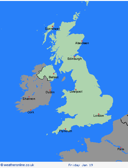
Weather Warnings Archive: Monday 15 Jan 2024 12:19 GMT - UK


00:00-06:00

06:00-12:00

12:00-18:00

18:00-24:00


Severe Weather Warnings: Snow/Ice
issued by the Metoffice at
12:19, 15.01.2024
valid from
00:00, 15.01.2024
until
23:59, 15.01.2024
Region: Orkney & Shetland
Frequent snow showers will continue to affect northern Scotland through Monday. A spell of strong northerly winds affecting the Northern Isles and northeast Scotland during the day will also result in drifting of lying snow in places. Whilst accumulations will vary due to the nature of showers, 2-5 cm of snow is expected in many places. Where showers become more organised, there is a chance some low-lying areas could see 10 cm in a few hours. What should I do? Snowy, wintry weather can cause delays and make driving conditions dangerous, so to keep yourself and others safe: plan your route, checking for delays and road closures, amending your travel plans if necessary; if driving, leave more time to prepare and check your car before setting off; make sure you have essentials packed in your car in the event of any delays (warm clothing, food, water, a blanket, a torch, ice scraper/de-icer, a warning triangle, high visibility vest and an in-car phone charger). If making a journey on foot, try to use pavements along main roads which are likely to be less slippery. Similarly, if cycling, try and stick to main roads which are more likely to have been treated. People cope better with power cuts when they have prepared for them in advance. It’s easy to do; consider gathering torches and batteries, a mobile phone power pack and other essential items. Be prepared for weather warnings to change quickly: when a weather warning is issued, the Met Office recommends staying up to date with the weather forecast in your area.
Chief ForecasterFrequent snow showers are likely to cause further disruption to travel on Monday
The public is advised to take extra care, further information and advice can be found here: http://www.metoffice.gov.uk/weather/uk/links.html
Severe Weather Warnings: Snow/Ice
issued by the Metoffice at
12:19, 15.01.2024
valid from
00:00, 16.01.2024
until
23:59, 16.01.2024
Region: Orkney & Shetland
Snow showers will continue to feed inland early on Tuesday morning across northern and western Scotland, parts of Wales and northwest England where 2-5 cm of snow is possible over a few hours in some places. During the day, an area of more organised rain, sleet and snow is likely to move east with further showers following. There is still some uncertainty in the track of more prolonged snow, and it is possible that at lower elevations across Wales and northern England, this could turn to rain for a time. However, there is a chance some places could see 5-10 cm perhaps 20 cm of snow, particularly across the northern half of Scotland and over higher ground elsewhere. What should I do? Snowy, wintry weather can cause delays and make driving conditions dangerous, so to keep yourself and others safe: plan your route, checking for delays and road closures, amending your travel plans if necessary; if driving, leave more time to prepare and check your car before setting off; make sure you have essentials packed in your car in the event of any delays (warm clothing, food, water, a blanket, a torch, ice scraper/de-icer, a warning triangle, high visibility vest and an in-car phone charger). If making a journey on foot, try to use pavements along main roads which are likely to be less slippery. Similarly, if cycling, try and stick to main roads which are more likely to have been treated. People cope better when they have prepared in advance for the risk of power cuts or being cut off from services and amenities due to the snow. It’s easy to do: consider gathering torches and batteries, a mobile phone power pack and other essential items. Be prepared for weather warnings to change quickly: when a weather warning is issued, the Met Office recommends staying up to date with the weather forecast in your area.
Chief ForecasterFurther snow showers, perhaps merging into a longer spell of snow, are likely to cause further disruption on Tuesday
The public is advised to take extra care, further information and advice can be found here: http://www.metoffice.gov.uk/weather/uk/links.html
Severe Weather Warnings: Snow/Ice
issued by the Metoffice at
12:19, 15.01.2024
valid from
00:00, 16.01.2024
until
23:59, 16.01.2024
Region: Highland & Eilean Siar
Snow showers will continue to feed inland early on Tuesday morning across northern and western Scotland, parts of Wales and northwest England where 2-5 cm of snow is possible over a few hours in some places. During the day, an area of more organised rain, sleet and snow is likely to move east with further showers following. There is still some uncertainty in the track of more prolonged snow, and it is possible that at lower elevations across Wales and northern England, this could turn to rain for a time. However, there is a chance some places could see 5-10 cm perhaps 20 cm of snow, particularly across the northern half of Scotland and over higher ground elsewhere. What should I do? Snowy, wintry weather can cause delays and make driving conditions dangerous, so to keep yourself and others safe: plan your route, checking for delays and road closures, amending your travel plans if necessary; if driving, leave more time to prepare and check your car before setting off; make sure you have essentials packed in your car in the event of any delays (warm clothing, food, water, a blanket, a torch, ice scraper/de-icer, a warning triangle, high visibility vest and an in-car phone charger). If making a journey on foot, try to use pavements along main roads which are likely to be less slippery. Similarly, if cycling, try and stick to main roads which are more likely to have been treated. People cope better when they have prepared in advance for the risk of power cuts or being cut off from services and amenities due to the snow. It’s easy to do: consider gathering torches and batteries, a mobile phone power pack and other essential items. Be prepared for weather warnings to change quickly: when a weather warning is issued, the Met Office recommends staying up to date with the weather forecast in your area.
Chief ForecasterFurther snow showers, perhaps merging into a longer spell of snow, are likely to cause further disruption on Tuesday
The public is advised to take extra care, further information and advice can be found here: http://www.metoffice.gov.uk/weather/uk/links.html
Severe Weather Warnings: Snow/Ice
issued by the Metoffice at
12:19, 15.01.2024
valid from
00:00, 15.01.2024
until
23:59, 15.01.2024
Region: Highland & Eilean Siar
Frequent snow showers will continue to affect northern Scotland through Monday. A spell of strong northerly winds affecting the Northern Isles and northeast Scotland during the day will also result in drifting of lying snow in places. Whilst accumulations will vary due to the nature of showers, 2-5 cm of snow is expected in many places. Where showers become more organised, there is a chance some low-lying areas could see 10 cm in a few hours. What should I do? Snowy, wintry weather can cause delays and make driving conditions dangerous, so to keep yourself and others safe: plan your route, checking for delays and road closures, amending your travel plans if necessary; if driving, leave more time to prepare and check your car before setting off; make sure you have essentials packed in your car in the event of any delays (warm clothing, food, water, a blanket, a torch, ice scraper/de-icer, a warning triangle, high visibility vest and an in-car phone charger). If making a journey on foot, try to use pavements along main roads which are likely to be less slippery. Similarly, if cycling, try and stick to main roads which are more likely to have been treated. People cope better with power cuts when they have prepared for them in advance. It’s easy to do; consider gathering torches and batteries, a mobile phone power pack and other essential items. Be prepared for weather warnings to change quickly: when a weather warning is issued, the Met Office recommends staying up to date with the weather forecast in your area.
Chief ForecasterFrequent snow showers are likely to cause further disruption to travel on Monday
The public is advised to take extra care, further information and advice can be found here: http://www.metoffice.gov.uk/weather/uk/links.html
Severe Weather Warnings: Snow/Ice
issued by the Metoffice at
12:19, 15.01.2024
valid from
00:00, 15.01.2024
until
23:59, 15.01.2024
Region: Grampian
Frequent snow showers will continue to affect northern Scotland through Monday. A spell of strong northerly winds affecting the Northern Isles and northeast Scotland during the day will also result in drifting of lying snow in places. Whilst accumulations will vary due to the nature of showers, 2-5 cm of snow is expected in many places. Where showers become more organised, there is a chance some low-lying areas could see 10 cm in a few hours. What should I do? Snowy, wintry weather can cause delays and make driving conditions dangerous, so to keep yourself and others safe: plan your route, checking for delays and road closures, amending your travel plans if necessary; if driving, leave more time to prepare and check your car before setting off; make sure you have essentials packed in your car in the event of any delays (warm clothing, food, water, a blanket, a torch, ice scraper/de-icer, a warning triangle, high visibility vest and an in-car phone charger). If making a journey on foot, try to use pavements along main roads which are likely to be less slippery. Similarly, if cycling, try and stick to main roads which are more likely to have been treated. People cope better with power cuts when they have prepared for them in advance. It’s easy to do; consider gathering torches and batteries, a mobile phone power pack and other essential items. Be prepared for weather warnings to change quickly: when a weather warning is issued, the Met Office recommends staying up to date with the weather forecast in your area.
Chief ForecasterFrequent snow showers are likely to cause further disruption to travel on Monday
The public is advised to take extra care, further information and advice can be found here: http://www.metoffice.gov.uk/weather/uk/links.html
Severe Weather Warnings: Snow/Ice
issued by the Metoffice at
12:19, 15.01.2024
valid from
00:00, 16.01.2024
until
23:59, 16.01.2024
Region: Grampian
Snow showers will continue to feed inland early on Tuesday morning across northern and western Scotland, parts of Wales and northwest England where 2-5 cm of snow is possible over a few hours in some places. During the day, an area of more organised rain, sleet and snow is likely to move east with further showers following. There is still some uncertainty in the track of more prolonged snow, and it is possible that at lower elevations across Wales and northern England, this could turn to rain for a time. However, there is a chance some places could see 5-10 cm perhaps 20 cm of snow, particularly across the northern half of Scotland and over higher ground elsewhere. What should I do? Snowy, wintry weather can cause delays and make driving conditions dangerous, so to keep yourself and others safe: plan your route, checking for delays and road closures, amending your travel plans if necessary; if driving, leave more time to prepare and check your car before setting off; make sure you have essentials packed in your car in the event of any delays (warm clothing, food, water, a blanket, a torch, ice scraper/de-icer, a warning triangle, high visibility vest and an in-car phone charger). If making a journey on foot, try to use pavements along main roads which are likely to be less slippery. Similarly, if cycling, try and stick to main roads which are more likely to have been treated. People cope better when they have prepared in advance for the risk of power cuts or being cut off from services and amenities due to the snow. It’s easy to do: consider gathering torches and batteries, a mobile phone power pack and other essential items. Be prepared for weather warnings to change quickly: when a weather warning is issued, the Met Office recommends staying up to date with the weather forecast in your area.
Chief ForecasterFurther snow showers, perhaps merging into a longer spell of snow, are likely to cause further disruption on Tuesday
The public is advised to take extra care, further information and advice can be found here: http://www.metoffice.gov.uk/weather/uk/links.html
Severe Weather Warnings: Snow/Ice
issued by the Metoffice at
12:19, 15.01.2024
valid from
00:00, 16.01.2024
until
23:59, 16.01.2024
Region: Strathclyde
Snow showers will continue to feed inland early on Tuesday morning across northern and western Scotland, parts of Wales and northwest England where 2-5 cm of snow is possible over a few hours in some places. During the day, an area of more organised rain, sleet and snow is likely to move east with further showers following. There is still some uncertainty in the track of more prolonged snow, and it is possible that at lower elevations across Wales and northern England, this could turn to rain for a time. However, there is a chance some places could see 5-10 cm perhaps 20 cm of snow, particularly across the northern half of Scotland and over higher ground elsewhere. What should I do? Snowy, wintry weather can cause delays and make driving conditions dangerous, so to keep yourself and others safe: plan your route, checking for delays and road closures, amending your travel plans if necessary; if driving, leave more time to prepare and check your car before setting off; make sure you have essentials packed in your car in the event of any delays (warm clothing, food, water, a blanket, a torch, ice scraper/de-icer, a warning triangle, high visibility vest and an in-car phone charger). If making a journey on foot, try to use pavements along main roads which are likely to be less slippery. Similarly, if cycling, try and stick to main roads which are more likely to have been treated. People cope better when they have prepared in advance for the risk of power cuts or being cut off from services and amenities due to the snow. It’s easy to do: consider gathering torches and batteries, a mobile phone power pack and other essential items. Be prepared for weather warnings to change quickly: when a weather warning is issued, the Met Office recommends staying up to date with the weather forecast in your area.
Chief ForecasterFurther snow showers, perhaps merging into a longer spell of snow, are likely to cause further disruption on Tuesday
The public is advised to take extra care, further information and advice can be found here: http://www.metoffice.gov.uk/weather/uk/links.html
Severe Weather Warnings: Snow/Ice
issued by the Metoffice at
12:19, 15.01.2024
valid from
00:00, 16.01.2024
until
23:59, 16.01.2024
Region: Central, Tayside & Fife
Snow showers will continue to feed inland early on Tuesday morning across northern and western Scotland, parts of Wales and northwest England where 2-5 cm of snow is possible over a few hours in some places. During the day, an area of more organised rain, sleet and snow is likely to move east with further showers following. There is still some uncertainty in the track of more prolonged snow, and it is possible that at lower elevations across Wales and northern England, this could turn to rain for a time. However, there is a chance some places could see 5-10 cm perhaps 20 cm of snow, particularly across the northern half of Scotland and over higher ground elsewhere. What should I do? Snowy, wintry weather can cause delays and make driving conditions dangerous, so to keep yourself and others safe: plan your route, checking for delays and road closures, amending your travel plans if necessary; if driving, leave more time to prepare and check your car before setting off; make sure you have essentials packed in your car in the event of any delays (warm clothing, food, water, a blanket, a torch, ice scraper/de-icer, a warning triangle, high visibility vest and an in-car phone charger). If making a journey on foot, try to use pavements along main roads which are likely to be less slippery. Similarly, if cycling, try and stick to main roads which are more likely to have been treated. People cope better when they have prepared in advance for the risk of power cuts or being cut off from services and amenities due to the snow. It’s easy to do: consider gathering torches and batteries, a mobile phone power pack and other essential items. Be prepared for weather warnings to change quickly: when a weather warning is issued, the Met Office recommends staying up to date with the weather forecast in your area.
Chief ForecasterFurther snow showers, perhaps merging into a longer spell of snow, are likely to cause further disruption on Tuesday
The public is advised to take extra care, further information and advice can be found here: http://www.metoffice.gov.uk/weather/uk/links.html
Severe Weather Warnings: Snow/Ice
issued by the Metoffice at
12:19, 15.01.2024
valid from
00:00, 16.01.2024
until
23:59, 16.01.2024
Region: SW Scotland, Lothian Borders
Snow showers will continue to feed inland early on Tuesday morning across northern and western Scotland, parts of Wales and northwest England where 2-5 cm of snow is possible over a few hours in some places. During the day, an area of more organised rain, sleet and snow is likely to move east with further showers following. There is still some uncertainty in the track of more prolonged snow, and it is possible that at lower elevations across Wales and northern England, this could turn to rain for a time. However, there is a chance some places could see 5-10 cm perhaps 20 cm of snow, particularly across the northern half of Scotland and over higher ground elsewhere. What should I do? Snowy, wintry weather can cause delays and make driving conditions dangerous, so to keep yourself and others safe: plan your route, checking for delays and road closures, amending your travel plans if necessary; if driving, leave more time to prepare and check your car before setting off; make sure you have essentials packed in your car in the event of any delays (warm clothing, food, water, a blanket, a torch, ice scraper/de-icer, a warning triangle, high visibility vest and an in-car phone charger). If making a journey on foot, try to use pavements along main roads which are likely to be less slippery. Similarly, if cycling, try and stick to main roads which are more likely to have been treated. People cope better when they have prepared in advance for the risk of power cuts or being cut off from services and amenities due to the snow. It’s easy to do: consider gathering torches and batteries, a mobile phone power pack and other essential items. Be prepared for weather warnings to change quickly: when a weather warning is issued, the Met Office recommends staying up to date with the weather forecast in your area.
Chief ForecasterFurther snow showers, perhaps merging into a longer spell of snow, are likely to cause further disruption on Tuesday
The public is advised to take extra care, further information and advice can be found here: http://www.metoffice.gov.uk/weather/uk/links.html
Severe Weather Warnings: Snow/Ice
issued by the Metoffice at
12:19, 15.01.2024
valid from
03:00, 15.01.2024
until
11:00, 16.01.2024
Region: Northern Ireland
Brisk northerly winds will drive snow showers well inland across Northern Ireland on Monday. Up to 5 cm of snow is likely over higher routes such as the Coleraine Mountain road and Glenshane Pass. At lower levels, a few cms can be expected, with northern counties expected to see the more frequent showers. Ice will be an additional hazard for all areas into the evening. An area of sleet and snow will move east during Tuesday morning, giving 1-3 cm of snow in places and increasing the iciness, before turning to rain as temperatures slowly rise. What should I do? Snowy, wintry weather can cause delays and make driving conditions dangerous. Keep yourself and others safe by planning your route, giving yourself extra time for your journey. Check for road closures or delays to public transport and amend plans if necessary. If driving, make sure you have some essentials in your car in the event of any delays (e.g., warm clothing, food, water, a blanket, a torch, ice scraper/de icer, a warning triangle, high visibility vest and an in-car phone charger). If you need to make a journey on foot, try to use pavements along main roads which are likely to be less slippery. Similarly, if cycling, try and stick to main roads which are more likely to have been treated. Be prepared for weather warnings to change quickly: when a weather warning is issued, the Met Office recommends staying up to date with the weather forecast in your area.
Chief ForecasterSnow showers bringing some disruption to parts of Northern Ireland.
The public is advised to take extra care, further information and advice can be found here: http://www.metoffice.gov.uk/weather/uk/links.html
Severe Weather Warnings: Ice
issued by the Metoffice at
12:19, 15.01.2024
valid from
05:01, 15.01.2024
until
11:00, 15.01.2024
Region: Wales
Sporadic wintry showers feeding into north Wales and parts of northwest England will lead to some icy stretches forming. What should I do? Keep yourself and your family safe when it is icy. Plan to leave the house at least five minutes earlier than normal. Not needing to rush, reduces your risk of accidents, slips, and falls. If you need to make a journey on foot, try to use pavements along main roads which are likely to be less slippery. Similarly, if cycling, try and stick to main roads which are more likely to have been treated. Give yourself the best chance of avoiding delays by checking road conditions if driving, or bus and train timetables, amending your travel plans if necessary. Be prepared for weather warnings to change: when a weather warning is issued, the Met Office recommends staying up to date with the weather forecast in your area
Chief ForecasterWintry showers falling on to cold surfaces leading to some icy stretches this morning
The public is advised to take extra care, further information and advice can be found here: http://www.metoffice.gov.uk/weather/uk/links.html
Severe Weather Warnings: Snow/Ice
issued by the Metoffice at
12:19, 15.01.2024
valid from
00:00, 16.01.2024
until
23:59, 16.01.2024
Region: Wales
Snow showers will continue to feed inland early on Tuesday morning across northern and western Scotland, parts of Wales and northwest England where 2-5 cm of snow is possible over a few hours in some places. During the day, an area of more organised rain, sleet and snow is likely to move east with further showers following. There is still some uncertainty in the track of more prolonged snow, and it is possible that at lower elevations across Wales and northern England, this could turn to rain for a time. However, there is a chance some places could see 5-10 cm perhaps 20 cm of snow, particularly across the northern half of Scotland and over higher ground elsewhere. What should I do? Snowy, wintry weather can cause delays and make driving conditions dangerous, so to keep yourself and others safe: plan your route, checking for delays and road closures, amending your travel plans if necessary; if driving, leave more time to prepare and check your car before setting off; make sure you have essentials packed in your car in the event of any delays (warm clothing, food, water, a blanket, a torch, ice scraper/de-icer, a warning triangle, high visibility vest and an in-car phone charger). If making a journey on foot, try to use pavements along main roads which are likely to be less slippery. Similarly, if cycling, try and stick to main roads which are more likely to have been treated. People cope better when they have prepared in advance for the risk of power cuts or being cut off from services and amenities due to the snow. It’s easy to do: consider gathering torches and batteries, a mobile phone power pack and other essential items. Be prepared for weather warnings to change quickly: when a weather warning is issued, the Met Office recommends staying up to date with the weather forecast in your area.
Chief ForecasterFurther snow showers, perhaps merging into a longer spell of snow, are likely to cause further disruption on Tuesday
The public is advised to take extra care, further information and advice can be found here: http://www.metoffice.gov.uk/weather/uk/links.html
Severe Weather Warnings: Snow/Ice
issued by the Metoffice at
12:19, 15.01.2024
valid from
00:00, 16.01.2024
until
23:59, 16.01.2024
Region: North West England
Snow showers will continue to feed inland early on Tuesday morning across northern and western Scotland, parts of Wales and northwest England where 2-5 cm of snow is possible over a few hours in some places. During the day, an area of more organised rain, sleet and snow is likely to move east with further showers following. There is still some uncertainty in the track of more prolonged snow, and it is possible that at lower elevations across Wales and northern England, this could turn to rain for a time. However, there is a chance some places could see 5-10 cm perhaps 20 cm of snow, particularly across the northern half of Scotland and over higher ground elsewhere. What should I do? Snowy, wintry weather can cause delays and make driving conditions dangerous, so to keep yourself and others safe: plan your route, checking for delays and road closures, amending your travel plans if necessary; if driving, leave more time to prepare and check your car before setting off; make sure you have essentials packed in your car in the event of any delays (warm clothing, food, water, a blanket, a torch, ice scraper/de-icer, a warning triangle, high visibility vest and an in-car phone charger). If making a journey on foot, try to use pavements along main roads which are likely to be less slippery. Similarly, if cycling, try and stick to main roads which are more likely to have been treated. People cope better when they have prepared in advance for the risk of power cuts or being cut off from services and amenities due to the snow. It’s easy to do: consider gathering torches and batteries, a mobile phone power pack and other essential items. Be prepared for weather warnings to change quickly: when a weather warning is issued, the Met Office recommends staying up to date with the weather forecast in your area.
Chief ForecasterFurther snow showers, perhaps merging into a longer spell of snow, are likely to cause further disruption on Tuesday
The public is advised to take extra care, further information and advice can be found here: http://www.metoffice.gov.uk/weather/uk/links.html
Severe Weather Warnings: Ice
issued by the Metoffice at
12:19, 15.01.2024
valid from
05:01, 15.01.2024
until
11:00, 15.01.2024
Region: North West England
Sporadic wintry showers feeding into north Wales and parts of northwest England will lead to some icy stretches forming. What should I do? Keep yourself and your family safe when it is icy. Plan to leave the house at least five minutes earlier than normal. Not needing to rush, reduces your risk of accidents, slips, and falls. If you need to make a journey on foot, try to use pavements along main roads which are likely to be less slippery. Similarly, if cycling, try and stick to main roads which are more likely to have been treated. Give yourself the best chance of avoiding delays by checking road conditions if driving, or bus and train timetables, amending your travel plans if necessary. Be prepared for weather warnings to change: when a weather warning is issued, the Met Office recommends staying up to date with the weather forecast in your area
Chief ForecasterWintry showers falling on to cold surfaces leading to some icy stretches this morning
The public is advised to take extra care, further information and advice can be found here: http://www.metoffice.gov.uk/weather/uk/links.html
Severe Weather Warnings: Snow/Ice
issued by the Metoffice at
12:19, 15.01.2024
valid from
00:00, 16.01.2024
until
23:59, 16.01.2024
Region: North East England
Snow showers will continue to feed inland early on Tuesday morning across northern and western Scotland, parts of Wales and northwest England where 2-5 cm of snow is possible over a few hours in some places. During the day, an area of more organised rain, sleet and snow is likely to move east with further showers following. There is still some uncertainty in the track of more prolonged snow, and it is possible that at lower elevations across Wales and northern England, this could turn to rain for a time. However, there is a chance some places could see 5-10 cm perhaps 20 cm of snow, particularly across the northern half of Scotland and over higher ground elsewhere. What should I do? Snowy, wintry weather can cause delays and make driving conditions dangerous, so to keep yourself and others safe: plan your route, checking for delays and road closures, amending your travel plans if necessary; if driving, leave more time to prepare and check your car before setting off; make sure you have essentials packed in your car in the event of any delays (warm clothing, food, water, a blanket, a torch, ice scraper/de-icer, a warning triangle, high visibility vest and an in-car phone charger). If making a journey on foot, try to use pavements along main roads which are likely to be less slippery. Similarly, if cycling, try and stick to main roads which are more likely to have been treated. People cope better when they have prepared in advance for the risk of power cuts or being cut off from services and amenities due to the snow. It’s easy to do: consider gathering torches and batteries, a mobile phone power pack and other essential items. Be prepared for weather warnings to change quickly: when a weather warning is issued, the Met Office recommends staying up to date with the weather forecast in your area.
Chief ForecasterFurther snow showers, perhaps merging into a longer spell of snow, are likely to cause further disruption on Tuesday
The public is advised to take extra care, further information and advice can be found here: http://www.metoffice.gov.uk/weather/uk/links.html
Severe Weather Warnings: Snow/Ice
issued by the Metoffice at
12:19, 15.01.2024
valid from
00:00, 16.01.2024
until
23:59, 16.01.2024
Region: Yorkshire & Humber
Snow showers will continue to feed inland early on Tuesday morning across northern and western Scotland, parts of Wales and northwest England where 2-5 cm of snow is possible over a few hours in some places. During the day, an area of more organised rain, sleet and snow is likely to move east with further showers following. There is still some uncertainty in the track of more prolonged snow, and it is possible that at lower elevations across Wales and northern England, this could turn to rain for a time. However, there is a chance some places could see 5-10 cm perhaps 20 cm of snow, particularly across the northern half of Scotland and over higher ground elsewhere. What should I do? Snowy, wintry weather can cause delays and make driving conditions dangerous, so to keep yourself and others safe: plan your route, checking for delays and road closures, amending your travel plans if necessary; if driving, leave more time to prepare and check your car before setting off; make sure you have essentials packed in your car in the event of any delays (warm clothing, food, water, a blanket, a torch, ice scraper/de-icer, a warning triangle, high visibility vest and an in-car phone charger). If making a journey on foot, try to use pavements along main roads which are likely to be less slippery. Similarly, if cycling, try and stick to main roads which are more likely to have been treated. People cope better when they have prepared in advance for the risk of power cuts or being cut off from services and amenities due to the snow. It’s easy to do: consider gathering torches and batteries, a mobile phone power pack and other essential items. Be prepared for weather warnings to change quickly: when a weather warning is issued, the Met Office recommends staying up to date with the weather forecast in your area.
Chief ForecasterFurther snow showers, perhaps merging into a longer spell of snow, are likely to cause further disruption on Tuesday
The public is advised to take extra care, further information and advice can be found here: http://www.metoffice.gov.uk/weather/uk/links.html
Severe Weather Warnings: Ice
issued by the Metoffice at
12:19, 15.01.2024
valid from
05:01, 15.01.2024
until
11:00, 15.01.2024
Region: West Midlands
Sporadic wintry showers feeding into north Wales and parts of northwest England will lead to some icy stretches forming. What should I do? Keep yourself and your family safe when it is icy. Plan to leave the house at least five minutes earlier than normal. Not needing to rush, reduces your risk of accidents, slips, and falls. If you need to make a journey on foot, try to use pavements along main roads which are likely to be less slippery. Similarly, if cycling, try and stick to main roads which are more likely to have been treated. Give yourself the best chance of avoiding delays by checking road conditions if driving, or bus and train timetables, amending your travel plans if necessary. Be prepared for weather warnings to change: when a weather warning is issued, the Met Office recommends staying up to date with the weather forecast in your area
Chief ForecasterWintry showers falling on to cold surfaces leading to some icy stretches this morning
The public is advised to take extra care, further information and advice can be found here: http://www.metoffice.gov.uk/weather/uk/links.html
Severe Weather Warnings: Snow/Ice
issued by the Metoffice at
12:19, 15.01.2024
valid from
00:00, 16.01.2024
until
23:59, 16.01.2024
Region: West Midlands
Snow showers will continue to feed inland early on Tuesday morning across northern and western Scotland, parts of Wales and northwest England where 2-5 cm of snow is possible over a few hours in some places. During the day, an area of more organised rain, sleet and snow is likely to move east with further showers following. There is still some uncertainty in the track of more prolonged snow, and it is possible that at lower elevations across Wales and northern England, this could turn to rain for a time. However, there is a chance some places could see 5-10 cm perhaps 20 cm of snow, particularly across the northern half of Scotland and over higher ground elsewhere. What should I do? Snowy, wintry weather can cause delays and make driving conditions dangerous, so to keep yourself and others safe: plan your route, checking for delays and road closures, amending your travel plans if necessary; if driving, leave more time to prepare and check your car before setting off; make sure you have essentials packed in your car in the event of any delays (warm clothing, food, water, a blanket, a torch, ice scraper/de-icer, a warning triangle, high visibility vest and an in-car phone charger). If making a journey on foot, try to use pavements along main roads which are likely to be less slippery. Similarly, if cycling, try and stick to main roads which are more likely to have been treated. People cope better when they have prepared in advance for the risk of power cuts or being cut off from services and amenities due to the snow. It’s easy to do: consider gathering torches and batteries, a mobile phone power pack and other essential items. Be prepared for weather warnings to change quickly: when a weather warning is issued, the Met Office recommends staying up to date with the weather forecast in your area.
Chief ForecasterFurther snow showers, perhaps merging into a longer spell of snow, are likely to cause further disruption on Tuesday
The public is advised to take extra care, further information and advice can be found here: http://www.metoffice.gov.uk/weather/uk/links.html
Severe Weather Warnings: Snow/Ice
issued by the Metoffice at
12:19, 15.01.2024
valid from
00:00, 16.01.2024
until
23:59, 16.01.2024
Region: East Midlands
Snow showers will continue to feed inland early on Tuesday morning across northern and western Scotland, parts of Wales and northwest England where 2-5 cm of snow is possible over a few hours in some places. During the day, an area of more organised rain, sleet and snow is likely to move east with further showers following. There is still some uncertainty in the track of more prolonged snow, and it is possible that at lower elevations across Wales and northern England, this could turn to rain for a time. However, there is a chance some places could see 5-10 cm perhaps 20 cm of snow, particularly across the northern half of Scotland and over higher ground elsewhere. What should I do? Snowy, wintry weather can cause delays and make driving conditions dangerous, so to keep yourself and others safe: plan your route, checking for delays and road closures, amending your travel plans if necessary; if driving, leave more time to prepare and check your car before setting off; make sure you have essentials packed in your car in the event of any delays (warm clothing, food, water, a blanket, a torch, ice scraper/de-icer, a warning triangle, high visibility vest and an in-car phone charger). If making a journey on foot, try to use pavements along main roads which are likely to be less slippery. Similarly, if cycling, try and stick to main roads which are more likely to have been treated. People cope better when they have prepared in advance for the risk of power cuts or being cut off from services and amenities due to the snow. It’s easy to do: consider gathering torches and batteries, a mobile phone power pack and other essential items. Be prepared for weather warnings to change quickly: when a weather warning is issued, the Met Office recommends staying up to date with the weather forecast in your area.
Chief ForecasterFurther snow showers, perhaps merging into a longer spell of snow, are likely to cause further disruption on Tuesday
The public is advised to take extra care, further information and advice can be found here: http://www.metoffice.gov.uk/weather/uk/links.html
Severe Weather Warnings: Snow/Ice
issued by the Metoffice at
12:19, 15.01.2024
valid from
07:00, 15.01.2024
until
23:59, 15.01.2024
Region: East of England
Snow showers are likely to affect parts of north and east Norfolk and northeast Suffolk, with a few places, particularly near the coast seeing 2-5 cm of snow. The showers will clear into the evening with untreated surfaces then becoming icy. What should I do? Snowy, wintry weather can cause delays and make driving conditions dangerous. Keep yourself and others safe by planning your route, giving yourself extra time for your journey. Check for road closures or delays to public transport and amend plans if necessary. If driving, make sure you have some essentials in your car in the event of any delays (e.g., warm clothing, food, water, a blanket, a torch, ice scraper/de icer, a warning triangle, high visibility vest and an in-car phone charger). If you need to make a journey on foot or by bike, try to use pavements along main roads which are likely to be less slippery. Be prepared for weather warnings to change quickly: when a weather warning is issued, the Met Office recommends staying up to date with the weather forecast in your area
Chief ForecasterSnow showers and then ice leading to some disruption to travel during Monday.
The public is advised to take extra care, further information and advice can be found here: http://www.metoffice.gov.uk/weather/uk/links.html


15.01.2024