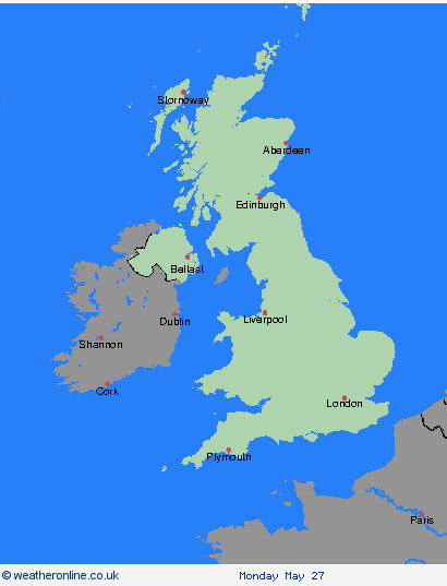
Weather Warnings Archive: Thursday 23 May 2024 12:00 BST - UK


00:00-06:00

06:00-12:00

12:00-18:00

18:00-24:00


Severe Weather Warnings: Rain
issued by the Metoffice at
11:00, 23.05.2024
valid from
17:00, 22.05.2024
until
10:00, 23.05.2024
Region: Orkney & Shetland
An area of heavy rain is expected to move northwestwards across the warning area during late Wednesday afternoon and persist overnight into Thursday morning, before turning somewhat lighter and patchier. Through this period, 20-30 mm of rain may accumulate quite widely, but some north-facing high ground may see well in excess of 60 mm of rain. Strong and gusty northerly winds may exacerbate any impacts from the rain. What should I do? Check if your property could be at risk of flooding. If so, consider preparing a flood plan and an emergency flood kit. Give yourself the best chance of avoiding delays by checking road conditions if driving, or bus and train timetables, amending your travel plans if necessary. People cope better with power cuts when they have prepared for them in advance. It’s easy to do; consider gathering torches and batteries, a mobile phone power pack and other essential items. Be prepared for weather warnings to change quickly: when a weather warning is issued, the Met Office recommends staying up to date with the weather forecast in your area.
Chief ForecasterHeavy rain may bring some disruption to western and northern Scotland.
The public is advised to take extra care, further information and advice can be found here: http://www.metoffice.gov.uk/weather/uk/links.html
Severe Weather Warnings: Rain
issued by the Metoffice at
11:00, 23.05.2024
valid from
17:00, 22.05.2024
until
10:00, 23.05.2024
Region: Highland & Eilean Siar
An area of heavy rain is expected to move northwestwards across the warning area during late Wednesday afternoon and persist overnight into Thursday morning, before turning somewhat lighter and patchier. Through this period, 20-30 mm of rain may accumulate quite widely, but some north-facing high ground may see well in excess of 60 mm of rain. Strong and gusty northerly winds may exacerbate any impacts from the rain. What should I do? Check if your property could be at risk of flooding. If so, consider preparing a flood plan and an emergency flood kit. Give yourself the best chance of avoiding delays by checking road conditions if driving, or bus and train timetables, amending your travel plans if necessary. People cope better with power cuts when they have prepared for them in advance. It’s easy to do; consider gathering torches and batteries, a mobile phone power pack and other essential items. Be prepared for weather warnings to change quickly: when a weather warning is issued, the Met Office recommends staying up to date with the weather forecast in your area.
Chief ForecasterHeavy rain may bring some disruption to western and northern Scotland.
The public is advised to take extra care, further information and advice can be found here: http://www.metoffice.gov.uk/weather/uk/links.html
Severe Weather Warnings: Rain
issued by the Metoffice at
11:00, 23.05.2024
valid from
12:00, 22.05.2024
until
03:00, 24.05.2024
Region: Strathclyde
Persistent rain will become more fragmented in nature during Thursday, but at the same time, some heavy, slow-moving bursts may develop across parts of southern and central Scotland. A further 10-20 mm, and in some places 30-40 mm is probable, across areas which have already seen between 20 mm and very locally 60 mm during this event. What should I do? Check if your property could be at risk of flooding. If so, consider preparing a flood plan and an emergency flood kit. Give yourself the best chance of avoiding delays by checking road conditions if driving, or bus and train timetables, amending your travel plans if necessary. People cope better with power cuts when they have prepared for them in advance. It’s easy to do; consider gathering torches and batteries, a mobile phone power pack and other essential items. Be prepared for weather warnings to change quickly: when a weather warning is issued, the Met Office recommends staying up to date with the weather forecast in your area.
Chief ForecasterFurther persistent rain may produce some flooding and transport disruption.
The public is advised to take extra care, further information and advice can be found here: http://www.metoffice.gov.uk/weather/uk/links.html
Severe Weather Warnings: Rain
issued by the Metoffice at
11:00, 23.05.2024
valid from
17:00, 22.05.2024
until
10:00, 23.05.2024
Region: Strathclyde
An area of heavy rain is expected to move northwestwards across the warning area during late Wednesday afternoon and persist overnight into Thursday morning, before turning somewhat lighter and patchier. Through this period, 20-30 mm of rain may accumulate quite widely, but some north-facing high ground may see well in excess of 60 mm of rain. Strong and gusty northerly winds may exacerbate any impacts from the rain. What should I do? Check if your property could be at risk of flooding. If so, consider preparing a flood plan and an emergency flood kit. Give yourself the best chance of avoiding delays by checking road conditions if driving, or bus and train timetables, amending your travel plans if necessary. People cope better with power cuts when they have prepared for them in advance. It’s easy to do; consider gathering torches and batteries, a mobile phone power pack and other essential items. Be prepared for weather warnings to change quickly: when a weather warning is issued, the Met Office recommends staying up to date with the weather forecast in your area.
Chief ForecasterHeavy rain may bring some disruption to western and northern Scotland.
The public is advised to take extra care, further information and advice can be found here: http://www.metoffice.gov.uk/weather/uk/links.html
Severe Weather Warnings: Rain
issued by the Metoffice at
11:00, 23.05.2024
valid from
12:00, 22.05.2024
until
03:00, 24.05.2024
Region: Central, Tayside & Fife
Persistent rain will become more fragmented in nature during Thursday, but at the same time, some heavy, slow-moving bursts may develop across parts of southern and central Scotland. A further 10-20 mm, and in some places 30-40 mm is probable, across areas which have already seen between 20 mm and very locally 60 mm during this event. What should I do? Check if your property could be at risk of flooding. If so, consider preparing a flood plan and an emergency flood kit. Give yourself the best chance of avoiding delays by checking road conditions if driving, or bus and train timetables, amending your travel plans if necessary. People cope better with power cuts when they have prepared for them in advance. It’s easy to do; consider gathering torches and batteries, a mobile phone power pack and other essential items. Be prepared for weather warnings to change quickly: when a weather warning is issued, the Met Office recommends staying up to date with the weather forecast in your area.
Chief ForecasterFurther persistent rain may produce some flooding and transport disruption.
The public is advised to take extra care, further information and advice can be found here: http://www.metoffice.gov.uk/weather/uk/links.html
Severe Weather Warnings: Rain
issued by the Metoffice at
11:00, 23.05.2024
valid from
12:00, 22.05.2024
until
03:00, 24.05.2024
Region: SW Scotland, Lothian Borders
Persistent rain will become more fragmented in nature during Thursday, but at the same time, some heavy, slow-moving bursts may develop across parts of southern and central Scotland. A further 10-20 mm, and in some places 30-40 mm is probable, across areas which have already seen between 20 mm and very locally 60 mm during this event. What should I do? Check if your property could be at risk of flooding. If so, consider preparing a flood plan and an emergency flood kit. Give yourself the best chance of avoiding delays by checking road conditions if driving, or bus and train timetables, amending your travel plans if necessary. People cope better with power cuts when they have prepared for them in advance. It’s easy to do; consider gathering torches and batteries, a mobile phone power pack and other essential items. Be prepared for weather warnings to change quickly: when a weather warning is issued, the Met Office recommends staying up to date with the weather forecast in your area.
Chief ForecasterFurther persistent rain may produce some flooding and transport disruption.
The public is advised to take extra care, further information and advice can be found here: http://www.metoffice.gov.uk/weather/uk/links.html
Severe Weather Warnings: Rain
issued by the Metoffice at
11:00, 23.05.2024
valid from
17:00, 22.05.2024
until
10:00, 23.05.2024
Region: Northern Ireland
An area of heavy rain is expected to move westwards into eastern parts of Northern Ireland during Wednesday. Whilst many areas may only see modest amounts of rain, there is the potential for parts of Antrim in particular to see 30-50 mm of rain quite widely and perhaps in excess of 60-80 mm over windward facing higher ground. Rainfall should tend to ease later on Thursday morning. Strong north to northwest winds, perhaps gusting to 50 mph at times, will likely exacerbate any impacts from the rainfall. What should I do? Check if your property could be at risk of flooding. If so, consider preparing a flood plan and an emergency flood kit. Give yourself the best chance of avoiding delays by checking road conditions if driving, or bus and train timetables, amending your travel plans if necessary. People cope better with power cuts when they have prepared for them in advance. It’s easy to do; consider gathering torches and batteries, a mobile phone power pack and other essential items. Be prepared for weather warnings to change quickly: when a weather warning is issued, the Met Office recommends staying up to date with the weather forecast in your area.
Chief ForecasterHeavy rain may bring some disruption to northeastern parts of Northern Ireland.
The public is advised to take extra care, further information and advice can be found here: http://www.metoffice.gov.uk/weather/uk/links.html
Severe Weather Warnings: Rain
issued by the Metoffice at
11:00, 23.05.2024
valid from
00:15, 22.05.2024
until
12:00, 23.05.2024
Region: Wales
An area of rain will continue to affect northwest England, parts of northeast England, parts of the north Midlands and north Wales. Rain will be heavy and persistent in places, particularly over north-facing hills and coasts, before easing during Thursday morning. Many places will see 30-40 mm of rain, while a few areas may receive 60-80 mm (including what has fallen so far). There is also a chance that a few upland locations, chiefly in the separate Amber warning area, could see much higher totals, in the order of 100-150 mm. What should I do? Check if your property could be at risk of flooding. If so, consider preparing a flood plan and an emergency flood kit. Give yourself the best chance of avoiding delays by checking road conditions if driving, or bus and train timetables, amending your travel plans if necessary. People cope better with power cuts when they have prepared for them in advance. It’s easy to do; consider gathering torches and batteries, a mobile phone power pack and other essential items. Be prepared for weather warnings to change quickly: when a weather warning is issued, the Met Office recommends staying up to date with the weather forecast in your area.
Chief ForecasterHeavy rain may cause some flooding and disruption to travel.
The public is advised to take extra care, further information and advice can be found here: http://www.metoffice.gov.uk/weather/uk/links.html
Severe Weather Warnings: Cancelled
issued by the Metoffice at
11:00, 23.05.2024
valid from
12:00, 22.05.2024
until
12:00, 23.05.2024
Region: Wales
Severe Weather Warnings: Cancelled
issued by the Metoffice at
11:00, 23.05.2024
valid from
12:00, 22.05.2024
until
12:00, 23.05.2024
Region: North West England
Severe Weather Warnings: Rain
issued by the Metoffice at
11:00, 23.05.2024
valid from
00:15, 22.05.2024
until
12:00, 23.05.2024
Region: North West England
An area of rain will continue to affect northwest England, parts of northeast England, parts of the north Midlands and north Wales. Rain will be heavy and persistent in places, particularly over north-facing hills and coasts, before easing during Thursday morning. Many places will see 30-40 mm of rain, while a few areas may receive 60-80 mm (including what has fallen so far). There is also a chance that a few upland locations, chiefly in the separate Amber warning area, could see much higher totals, in the order of 100-150 mm. What should I do? Check if your property could be at risk of flooding. If so, consider preparing a flood plan and an emergency flood kit. Give yourself the best chance of avoiding delays by checking road conditions if driving, or bus and train timetables, amending your travel plans if necessary. People cope better with power cuts when they have prepared for them in advance. It’s easy to do; consider gathering torches and batteries, a mobile phone power pack and other essential items. Be prepared for weather warnings to change quickly: when a weather warning is issued, the Met Office recommends staying up to date with the weather forecast in your area.
Chief ForecasterHeavy rain may cause some flooding and disruption to travel.
The public is advised to take extra care, further information and advice can be found here: http://www.metoffice.gov.uk/weather/uk/links.html
Severe Weather Warnings: Rain
issued by the Metoffice at
11:00, 23.05.2024
valid from
00:15, 22.05.2024
until
12:00, 23.05.2024
Region: North East England
An area of rain will continue to affect northwest England, parts of northeast England, parts of the north Midlands and north Wales. Rain will be heavy and persistent in places, particularly over north-facing hills and coasts, before easing during Thursday morning. Many places will see 30-40 mm of rain, while a few areas may receive 60-80 mm (including what has fallen so far). There is also a chance that a few upland locations, chiefly in the separate Amber warning area, could see much higher totals, in the order of 100-150 mm. What should I do? Check if your property could be at risk of flooding. If so, consider preparing a flood plan and an emergency flood kit. Give yourself the best chance of avoiding delays by checking road conditions if driving, or bus and train timetables, amending your travel plans if necessary. People cope better with power cuts when they have prepared for them in advance. It’s easy to do; consider gathering torches and batteries, a mobile phone power pack and other essential items. Be prepared for weather warnings to change quickly: when a weather warning is issued, the Met Office recommends staying up to date with the weather forecast in your area.
Chief ForecasterHeavy rain may cause some flooding and disruption to travel.
The public is advised to take extra care, further information and advice can be found here: http://www.metoffice.gov.uk/weather/uk/links.html
Severe Weather Warnings: Cancelled
issued by the Metoffice at
11:00, 23.05.2024
valid from
12:00, 22.05.2024
until
12:00, 23.05.2024
Region: Yorkshire & Humber
Severe Weather Warnings: Rain
issued by the Metoffice at
11:00, 23.05.2024
valid from
00:15, 22.05.2024
until
12:00, 23.05.2024
Region: Yorkshire & Humber
An area of rain will continue to affect northwest England, parts of northeast England, parts of the north Midlands and north Wales. Rain will be heavy and persistent in places, particularly over north-facing hills and coasts, before easing during Thursday morning. Many places will see 30-40 mm of rain, while a few areas may receive 60-80 mm (including what has fallen so far). There is also a chance that a few upland locations, chiefly in the separate Amber warning area, could see much higher totals, in the order of 100-150 mm. What should I do? Check if your property could be at risk of flooding. If so, consider preparing a flood plan and an emergency flood kit. Give yourself the best chance of avoiding delays by checking road conditions if driving, or bus and train timetables, amending your travel plans if necessary. People cope better with power cuts when they have prepared for them in advance. It’s easy to do; consider gathering torches and batteries, a mobile phone power pack and other essential items. Be prepared for weather warnings to change quickly: when a weather warning is issued, the Met Office recommends staying up to date with the weather forecast in your area.
Chief ForecasterHeavy rain may cause some flooding and disruption to travel.
The public is advised to take extra care, further information and advice can be found here: http://www.metoffice.gov.uk/weather/uk/links.html
Severe Weather Warnings: Rain
issued by the Metoffice at
11:00, 23.05.2024
valid from
00:15, 22.05.2024
until
12:00, 23.05.2024
Region: West Midlands
An area of rain will continue to affect northwest England, parts of northeast England, parts of the north Midlands and north Wales. Rain will be heavy and persistent in places, particularly over north-facing hills and coasts, before easing during Thursday morning. Many places will see 30-40 mm of rain, while a few areas may receive 60-80 mm (including what has fallen so far). There is also a chance that a few upland locations, chiefly in the separate Amber warning area, could see much higher totals, in the order of 100-150 mm. What should I do? Check if your property could be at risk of flooding. If so, consider preparing a flood plan and an emergency flood kit. Give yourself the best chance of avoiding delays by checking road conditions if driving, or bus and train timetables, amending your travel plans if necessary. People cope better with power cuts when they have prepared for them in advance. It’s easy to do; consider gathering torches and batteries, a mobile phone power pack and other essential items. Be prepared for weather warnings to change quickly: when a weather warning is issued, the Met Office recommends staying up to date with the weather forecast in your area.
Chief ForecasterHeavy rain may cause some flooding and disruption to travel.
The public is advised to take extra care, further information and advice can be found here: http://www.metoffice.gov.uk/weather/uk/links.html
Severe Weather Warnings: Rain
issued by the Metoffice at
11:00, 23.05.2024
valid from
00:15, 22.05.2024
until
12:00, 23.05.2024
Region: East Midlands
An area of rain will continue to affect northwest England, parts of northeast England, parts of the north Midlands and north Wales. Rain will be heavy and persistent in places, particularly over north-facing hills and coasts, before easing during Thursday morning. Many places will see 30-40 mm of rain, while a few areas may receive 60-80 mm (including what has fallen so far). There is also a chance that a few upland locations, chiefly in the separate Amber warning area, could see much higher totals, in the order of 100-150 mm. What should I do? Check if your property could be at risk of flooding. If so, consider preparing a flood plan and an emergency flood kit. Give yourself the best chance of avoiding delays by checking road conditions if driving, or bus and train timetables, amending your travel plans if necessary. People cope better with power cuts when they have prepared for them in advance. It’s easy to do; consider gathering torches and batteries, a mobile phone power pack and other essential items. Be prepared for weather warnings to change quickly: when a weather warning is issued, the Met Office recommends staying up to date with the weather forecast in your area.
Chief ForecasterHeavy rain may cause some flooding and disruption to travel.
The public is advised to take extra care, further information and advice can be found here: http://www.metoffice.gov.uk/weather/uk/links.html
Severe Weather Warnings: Cancelled
issued by the Metoffice at
11:00, 23.05.2024
valid from
12:00, 22.05.2024
until
12:00, 23.05.2024
Region: East Midlands