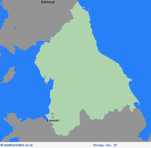
Weather Warnings Archive: Thursday 21 Nov 2024 11:22 GMT - UK


Severe Weather Warnings: Rain/Snow
issued by the Metoffice at
11:22, 21.11.2024
valid from
04:00, 23.11.2024
until
09:00, 24.11.2024
Region: North West England
Outbreaks of rain will spread northeastwards on Saturday, preceded by a spell of snow across parts of northern England and Scotland. Whilst snow will become increasingly confined to higher elevations with time, there is the chance of a transient period of snow to low levels in some areas, with perhaps as much as 5-10 cm accumulating in places, especially the Vale of York, before turning back to rain. Temporary snow accumulations of 10-20 cm are possible on ground above 150m, with perhaps as much as 20-40 cm above 300m. In conjunction with strengthening winds, difficult driving conditions are likely, especially over higher level routes, with possibly some interruptions to power supplies. In addition, the rapid thaw of lying snow as milder air arrives, with perhaps an additional 20-40 mm of rain in some upland areas during Saturday night, will lead to a greater likelihood of rainfall impacts later in the period. What should I do? Snowy, wintry weather can cause delays and make driving conditions dangerous, so to keep yourself and others safe: plan your route, checking for delays and road closures, amending your travel plans if necessary; if driving, leave more time to prepare and check your car before setting off; make sure you have essentials packed in your car in the event of any delays (warm clothing, food, water, a blanket, a torch, ice scraper/de-icer, a warning triangle, high visibility vest and an in-car phone charger). People cope better when they have prepared in advance for the risk of power cuts or being cut off from services and amenities due to the snow. It’s easy to do; consider gathering torches and batteries, a mobile phone power pack and other essential items. Check if your property could be at risk of flooding. If so, consider preparing a flood plan and an emergency flood kit. Be prepared for weather warnings to change quickly: when a weather warning is issued, the Met Office recommends staying up to date with the weather forecast in your area.
Chief ForecasterHeavy snow on Saturday, followed by a rapid thaw and subsequent rain on Saturday night, may cause some disruption
The public is advised to take extra care, further information and advice can be found here: http://www.metoffice.gov.uk/weather/uk/links.html
Severe Weather Warnings: Wind
issued by the Metoffice at
11:22, 21.11.2024
valid from
05:00, 23.11.2024
until
19:00, 23.11.2024
Region: North West England
A period of strong southeasterly winds is likely for a time on Saturday, with peak gusts of 50-60 mph in many parts of the warning area, but 60-70 mph in some coastal areas and also locally to the lee (northwest) of high ground, and perhaps in excess of 70 mph along some exposed coasts of Northern Ireland and western Scotland. What should I do? Give yourself the best chance of avoiding delays by checking road conditions if driving, or bus and train timetables, amending your travel plans if necessary. People cope better with power cuts when they have prepared for them in advance. It’s easy to do; consider gathering torches and batteries, a mobile phone power pack and other essential items. If you are on the coast, stay safe during stormy weather by being aware of large waves. Even from the shore large breaking waves can sweep you off your feet and out to sea. Take care if walking near cliffs; know your route and keep dogs on a lead. In an emergency, call 999 and ask for the Coastguard. Be prepared for weather warnings to change quickly: when a weather warning is issued, the Met Office recommends staying up to date with the weather forecast in your area.
Chief ForecasterStorm Bert will bring strong winds for a time on Saturday, which may cause some disruption in places
The public is advised to take extra care, further information and advice can be found here: http://www.metoffice.gov.uk/weather/uk/links.html
21.11.2024


